CONSTRUCTION
Construction & stockpiles
Progress maps on a regular schedule, cut-and-fill checks, and stockpile volumes for gravel yards, landscapers and contractors.
- Progress orthomosaics
- Volume reports
- Elevation models
Accurate aerial maps, elevation models and volume reports for builders, landowners, ranches and golf courses across southwest Montana. Flown, processed and delivered by a local pilot.

Every job starts with a planned, overlapping grid flight. The photos are stitched into a single high-resolution map and a 3D surface, so you can measure distances, areas and volumes from your desk.
Progress maps on a regular schedule, cut-and-fill checks, and stockpile volumes for gravel yards, landscapers and contractors.
Current, sharp imagery of acreage, pastures, fences, water and roads, for planning, listings and conservation easement monitoring.
Fast post-storm flights that record roof and crop damage with dated, georeferenced imagery for owners, farmers, agents and adjusters.
Repeat flights through the season that help superintendents spot dry areas, thinning turf and drainage problems before they spread.
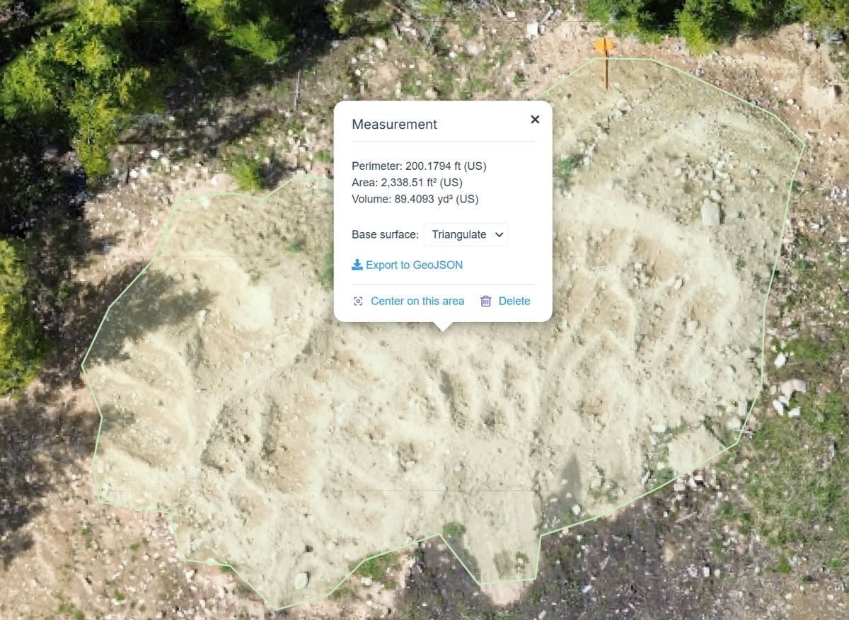
One flight, then a measured outline on the finished map. The volume comes from the 3D surface under that outline, so you know what's in the pile without a tape or a guess.
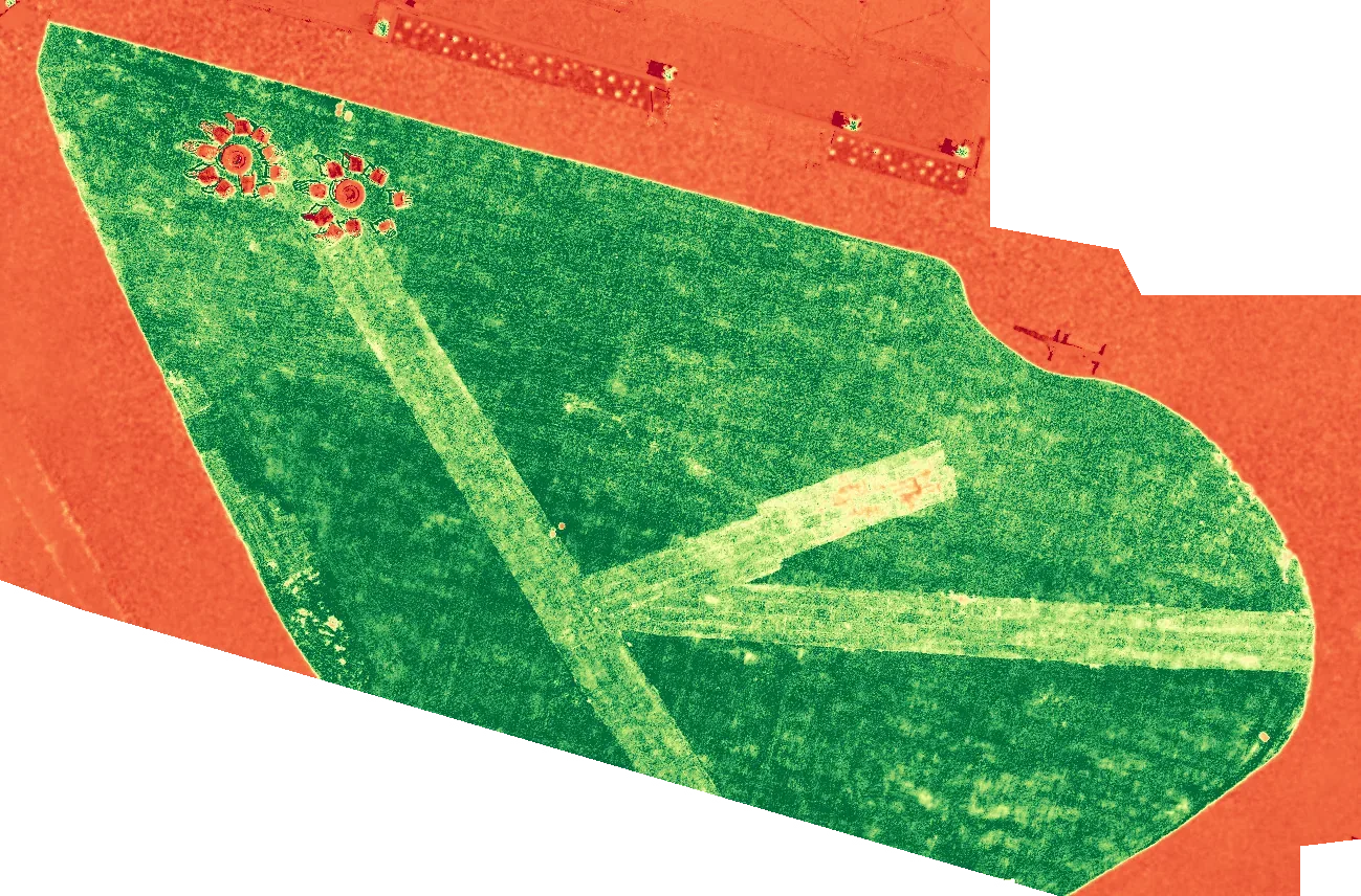
This map colors every pixel by how green and vigorous the plants are. On this commercial lawn re-sod job, the lighter strips are newly laid sod that is still rooting in. Repeat flights show when it catches up to the rest of the lawn.
GLI (Green Leaf Index) gives the cleanest read on grass from a standard camera.
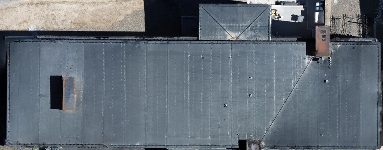
One flight maps an entire roof, sharp enough to see seams, vents and wear. On this commercial membrane roof, rust is showing on a metal rooftop curb. The same capture documents roofs before and after a hailstorm.
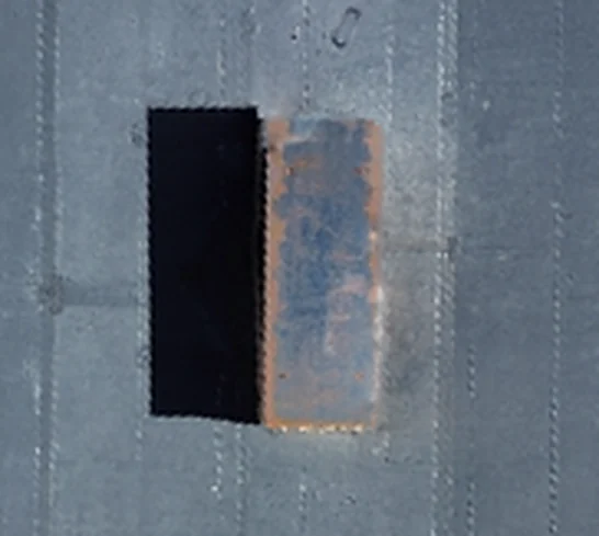
Rust on a metal curb, where the roof membrane meets a rooftop opening. Seams and flashing around spots like this are common places for leaks to start.
Low passes over each roof plane, close enough to check individual shingles. Tap a photo to enlarge.
Built from 407 aerial photos, this textured 3D model shows the terrain, buildings, roads and tree cover the way a buyer, builder or landowner would want to see them. Spin it, tilt it and zoom in.
About 15 MB, so best on Wi-Fi. Drag to rotate, pinch or scroll to zoom.
One seamless, true-to-scale photo map. Opens in Google Earth, GIS and CAD software.
A 3D surface of the site, with contour lines for planning drainage, grading and roads.
Stockpile volumes, acreage and measurements, with a marked-up map you can share.
Zoom, measure and compare dates in a browser, with nothing to install.
Need survey-grade accuracy? We set ground control points for jobs that must line up with real-world coordinates. For legal property boundaries, we work alongside licensed land surveyors.
Tell us the site, what you need to measure and your deadline. We send a clear quote.
We review FAA airspace, weather and site access, and get any authorization needed.
A planned grid flight on a calm day, with ground control set when accuracy matters.
Photos are stitched into maps and models, checked, and sent with a short summary.
The same pilot behind the maps also shoots smooth aerial and fly-through video. Add it to a mapping job or book it on its own.
Tee-to-green flights for each hole, made for course websites and booking pages.
Sweeping and fly-through footage that sets high-end land and home listings apart.
Progress and completion videos for builders and developers, paired with your maps.
Farther out? Ask. Travel is quoted up front.
Call or email with the location, rough acreage and what you need. Follow along on Instagram for recent maps and flights. We'll reply with a quote, usually within one business day.